

Land surveying, in its simplest form, will involve both mapping and measuring a certain environment by using specialized equipment, technology, and of course, mathematics. However, don’t be fooled into believing that surveyors solely deal with land, as they measure a vast array of objects and environments. These include on land, in the sky, on the bed of a river, sea, or ocean and there have even been surveyors who have traveled and resided in bitter and dangerous conditions in order to measure the polar ice caps.
What Tasks Does a Surveyor Undertake?
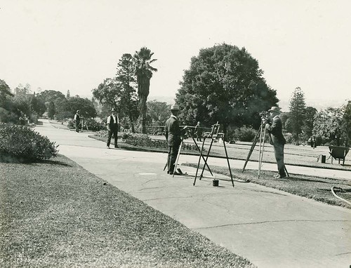
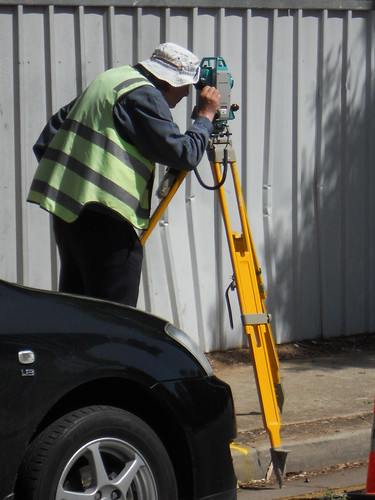
The vast majority of land surveyors will fulfill their roles both in the office and out in the field. Whilst a surveyor is out in the field they will typically use some very high-tech equipment, including Robotic Total Stations, GPS, and scanners to be used both terrestrially and aerially. This equipment will then be used to make certain calculations, map out an entire area, and also to take photographs. Working in the office doesn’t mean the equipment used will be any less high-tech and the most common software used in the office is Autocad. This software will allow a surveyor to map out measurements, as well as create plans and drafts.
There are also a vast array of projects that a surveyor will work on, including mining exploration, huge construction projects, land subdivision and even the building of tunnels. This means that a surveyor’s working week could be extremely varied and they may need completely different equipment to perform these different tasks. A surveyor can also be viewed as an expert in the field of understanding and determining measurements and land size. In fact, architects, developers and engineers will often turn to surveyors for advice and further information on certain projects.
Spatial Science
Spatial science is closely related to the work that surveyors complete, as well as Geospatial science. This will actually help a surveyor to understand environmental relationships with the surrounding community and this information can help a professional to predict certain patterns or trends within the set environment. One of the most commonly used spatial science technologies in the modern-day (by everyone and not just surveyors) is Google Maps and the use of GPS. Spatial science can also be used to predict future changes to the environment or worrying trends, such as natural disasters, including floods, tsunamis, etc.
Surveying is Probably More Important than You Think
We are probably more dependent on surveying than we actually think – surveyors will develop land, and they will help to plan and design roads, landscapes, and many essential utilities we typically take for granted. Surveyors will also work very closely with many other professionals, including architects, engineers, and those working in planning and geology. In fact, the person to generally arrive first at a construction site will be a surveyor, as they will need to map out the land and provide measurements, which will be used by the other professionals. This information will allow an architect to get the best use out of any land or a landscape, whereas an engineer can safely and accurately plan the structures that will become part of the landscape.

Jenny Zamora is a trusted Orlando Realtor with Orlando Realty Consultants, known for helping buyers, sellers, and investors navigate the Central Florida market with clarity and confidence. Jenny takes a relationship-first approach—listening closely, educating her clients, and guiding each step with honest advice and strong negotiation. Whether you’re buying your first home, relocating, selling to upgrade, or exploring investment opportunities, Jenny is committed to making the process smooth, strategic, and stress-free.
To learn more about Jenny’s professional membership and credentials, visit her REALTOR® member profile here.